
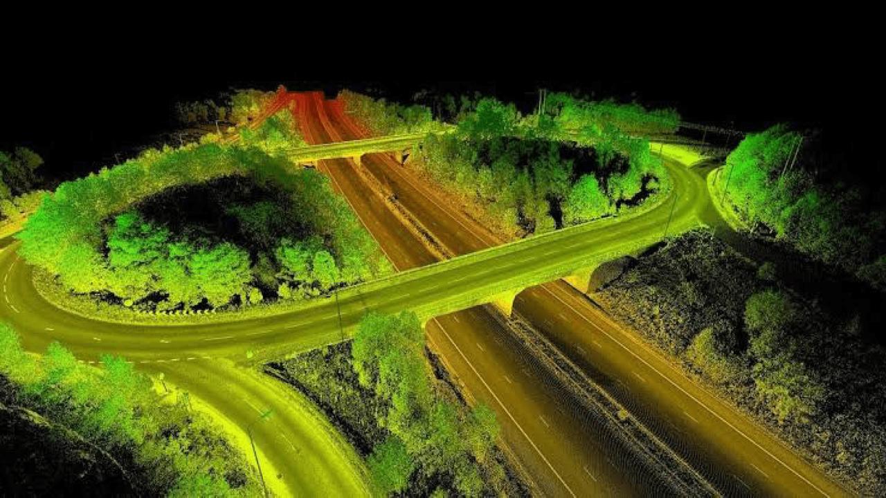
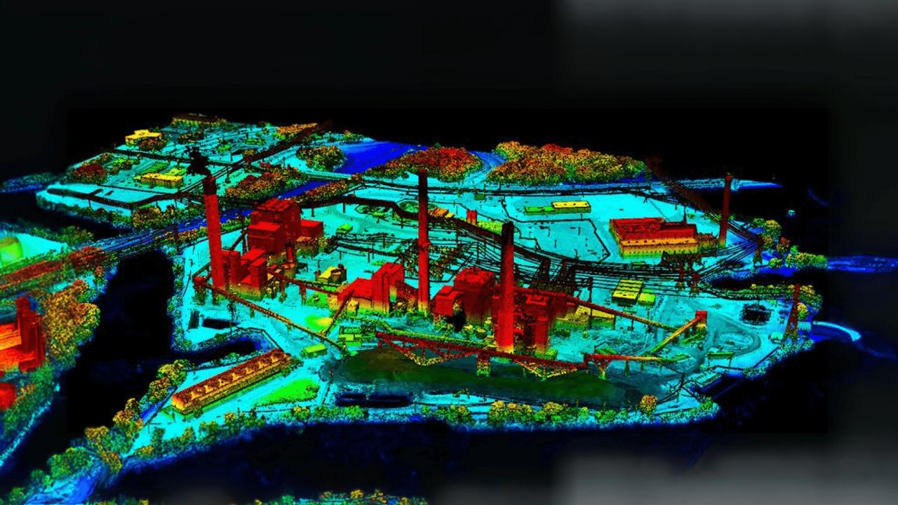
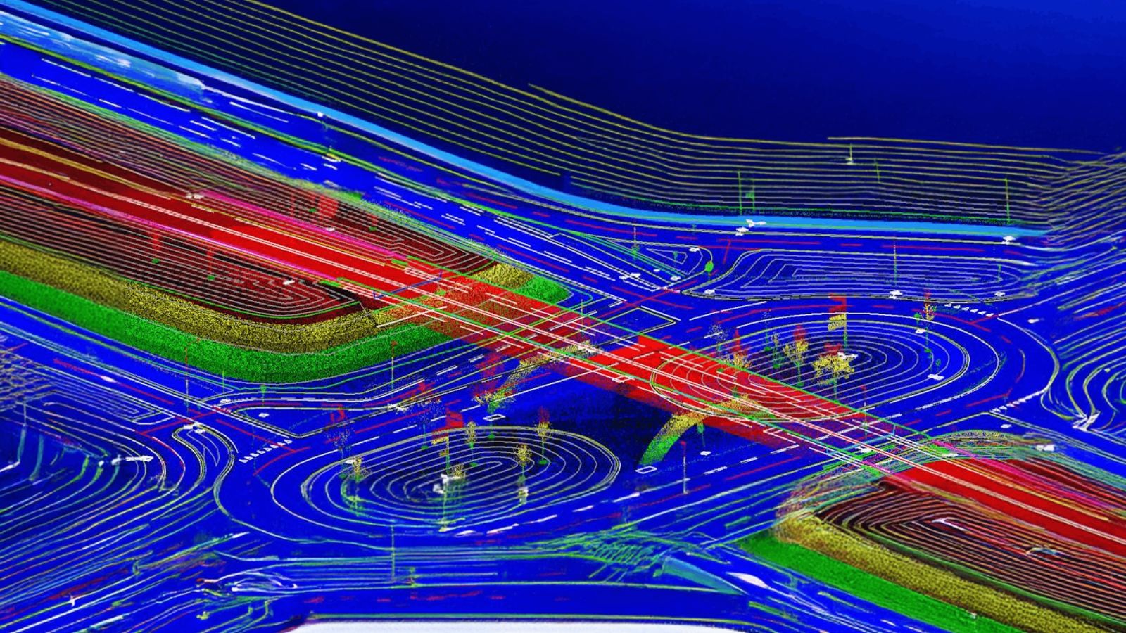
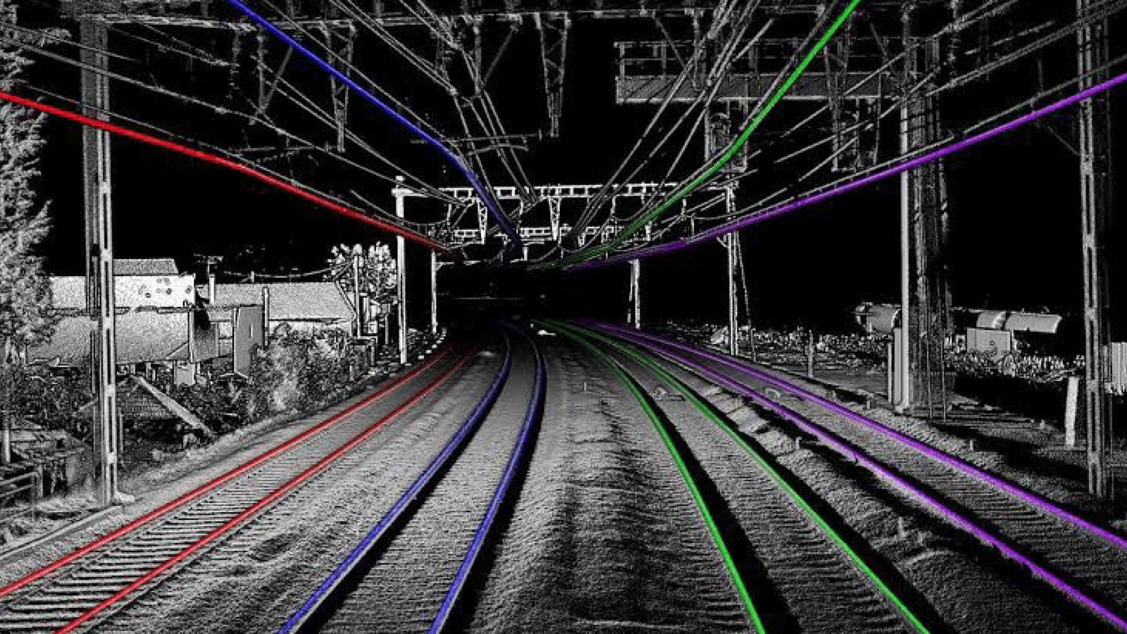
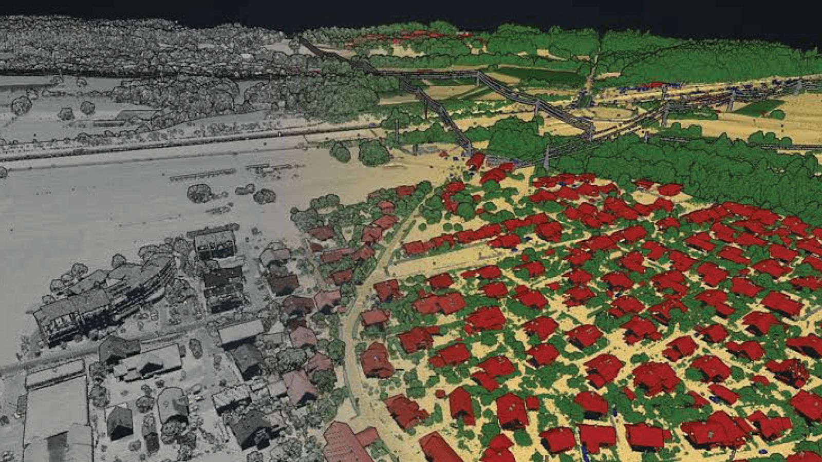
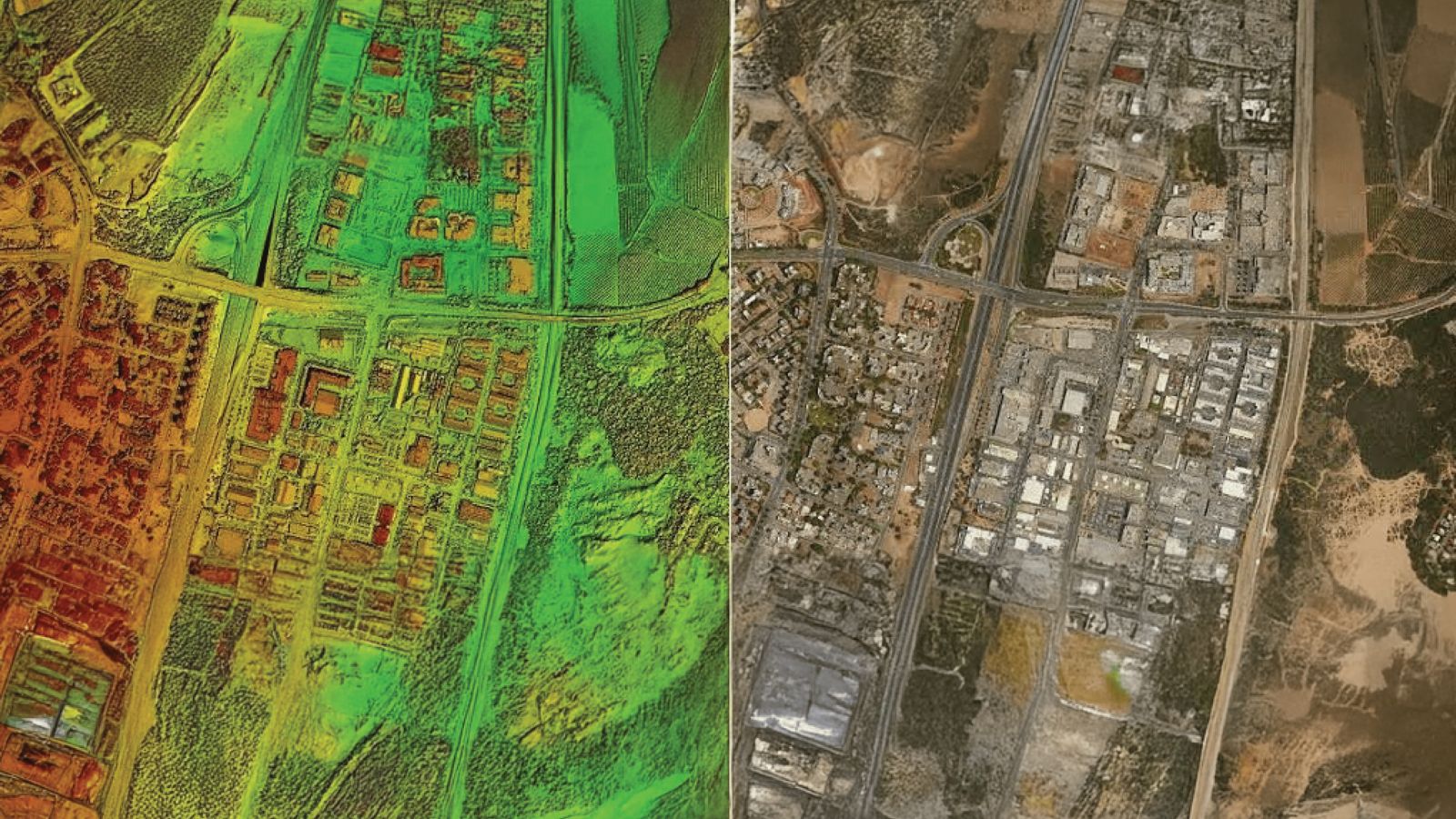
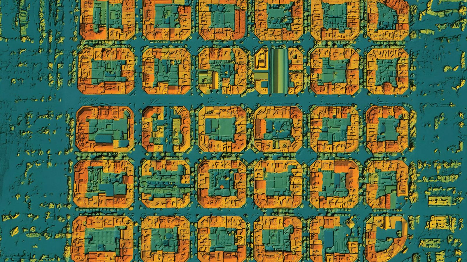
At MAAGNITE, we offer comprehensive LIDAR data processing services designed to transform raw point cloud data into accurate, actionable insights. Leveraging advanced tools and industry expertise, we handle everything from data cleaning and classification to feature extraction and 3D modeling. Our team ensures that your LIDAR data is not only precise but also optimized for a wide range of applications including urban planning, infrastructure development, forestry, mining, and environmental monitoring.
We specialize in processing airborne, terrestrial, and mobile LIDAR datasets, delivering high-resolution outputs such as Digital Terrain Models (DTMs), Digital Surface Models (DSMs), contour maps, volumetric analysis, and detailed topographic mapping. Our workflow is built on accuracy and efficiency, ensuring minimal data noise and consistent results that align with your project specifications.
Whether you're working on large-scale geospatial projects or need tailored solutions for engineering or environmental assessments, our LIDAR processing services provide the reliability and detail you need to make informed decisions. Partner with us for scalable, end-to-end solutions that bring clarity and depth to your spatial data.


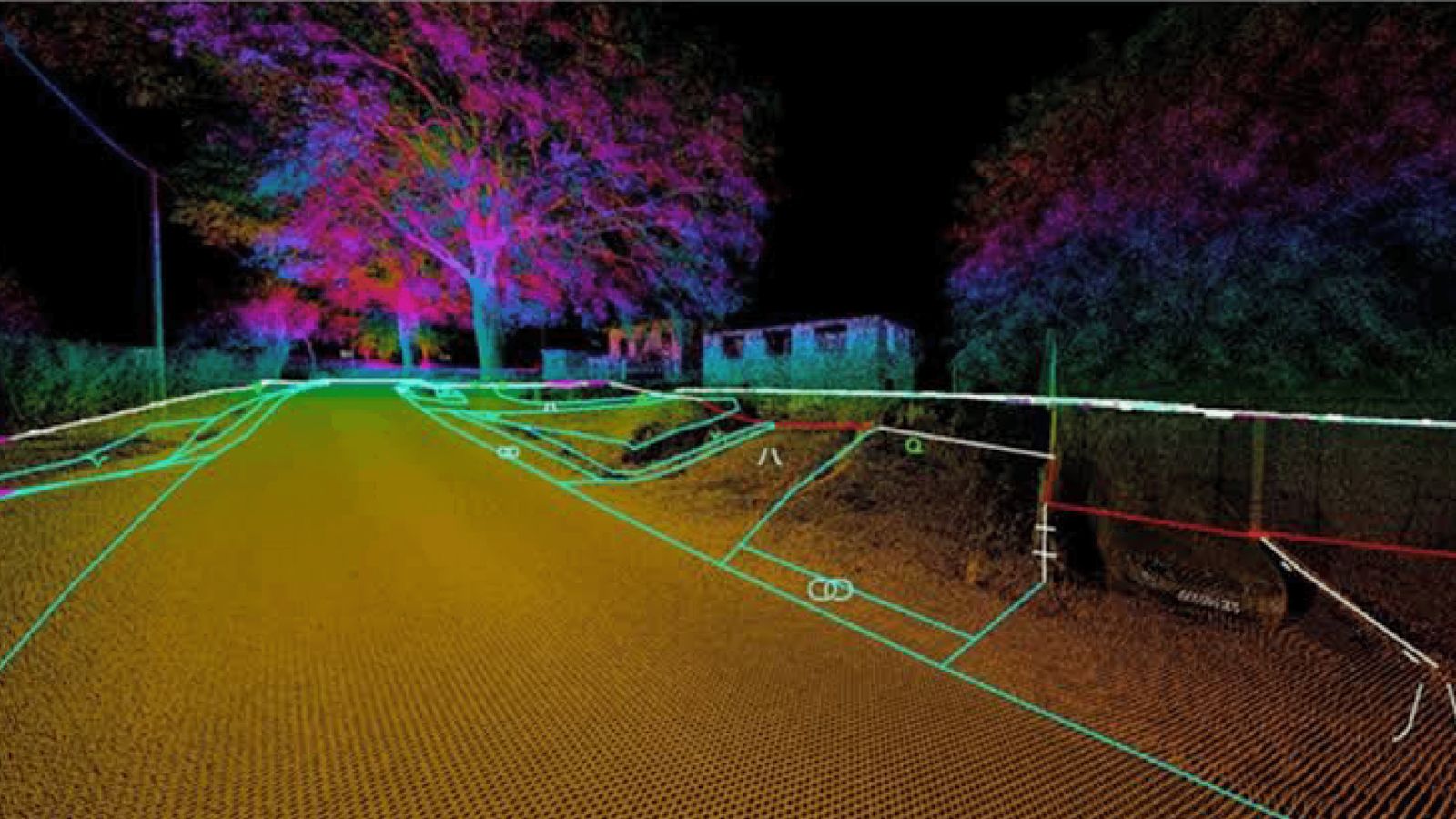
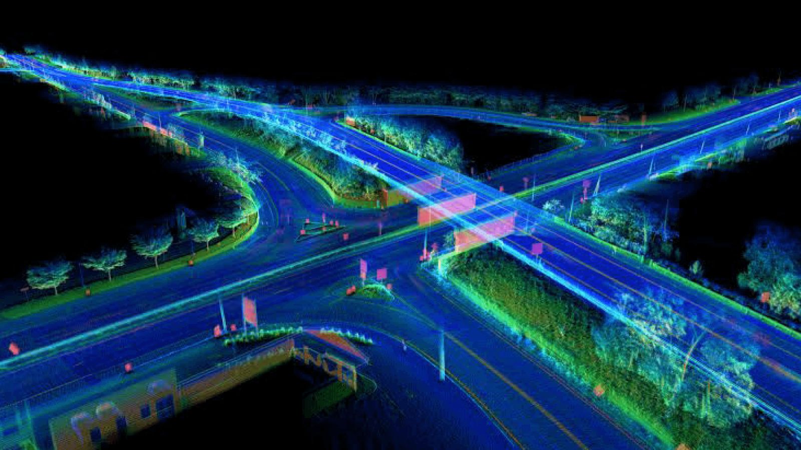
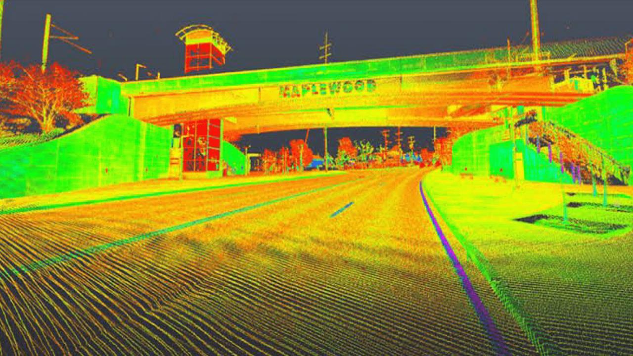
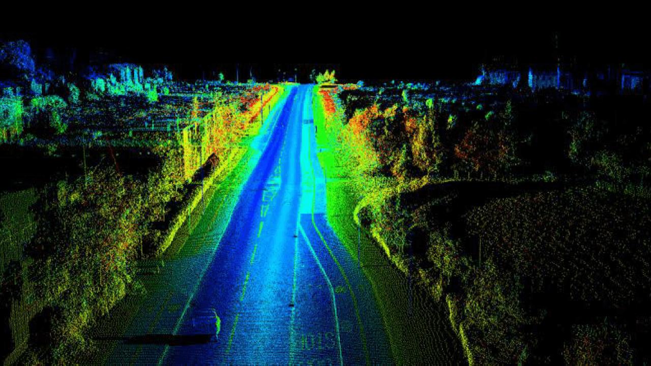
Our Mobile Mapping Services offer a fast, accurate, and cost-effective solution for capturing geospatial data over large areas. Using state-of-the-art mobile LIDAR systems, high-resolution imagery, and GNSS technology mounted on vehicles, we collect detailed, geo-referenced data in real-time while in motion. This method drastically reduces field time and minimizes disruptions in high-traffic or hard-to-access environments.
By leveraging mobile mapping, clients benefit from improved project timelines, enhanced data consistency, and safer data collection. Whether you're planning a large-scale infrastructure project or need up-to-date asset documentation, our team delivers the reliable, high-quality geospatial data you need to make informed decisions.

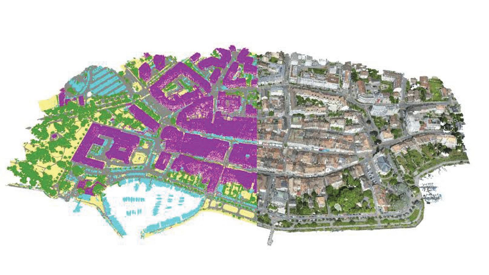
At MAAGNITE, we offer high-precision photogrammetry services that transform images into accurate 2D maps and 3D models. Using advanced drones, cameras, and software, we capture detailed spatial data from aerial or ground-based photography. This data is then processed into georeferenced maps, orthophotos, digital elevation models (DEMs), and 3D reconstructions suitable for a wide range of industries.
Our photogrammetry solutions are ideal for construction monitoring, topographic mapping, land surveying, mining, agriculture, and infrastructure projects. By leveraging cutting-edge technology, we deliver fast, cost-effective, and highly accurate visual data that enhances planning, analysis, and decision-making.
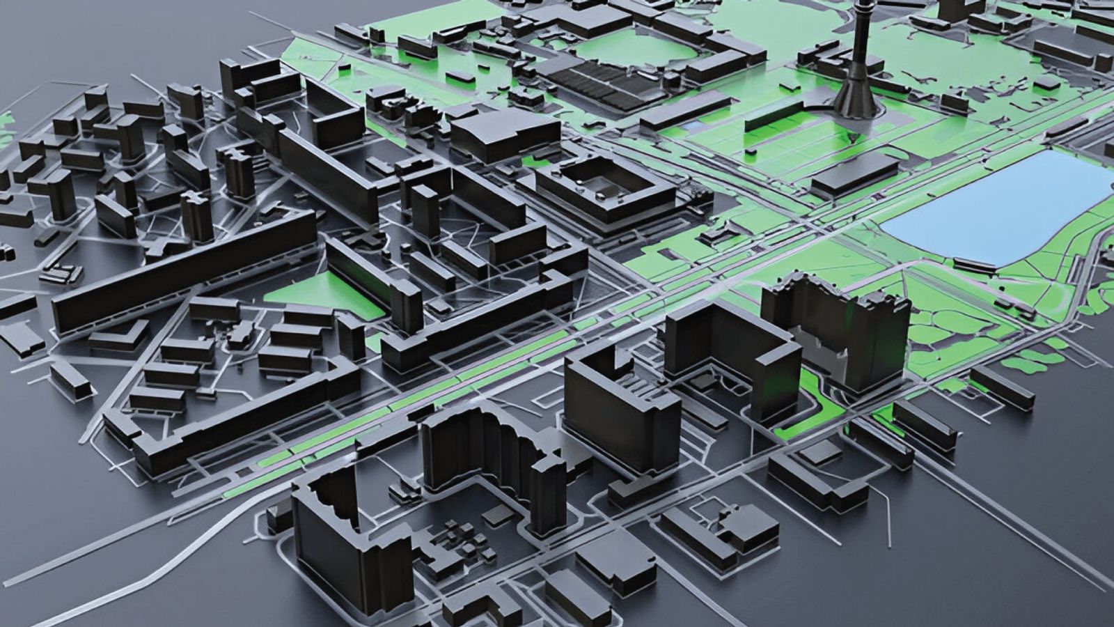
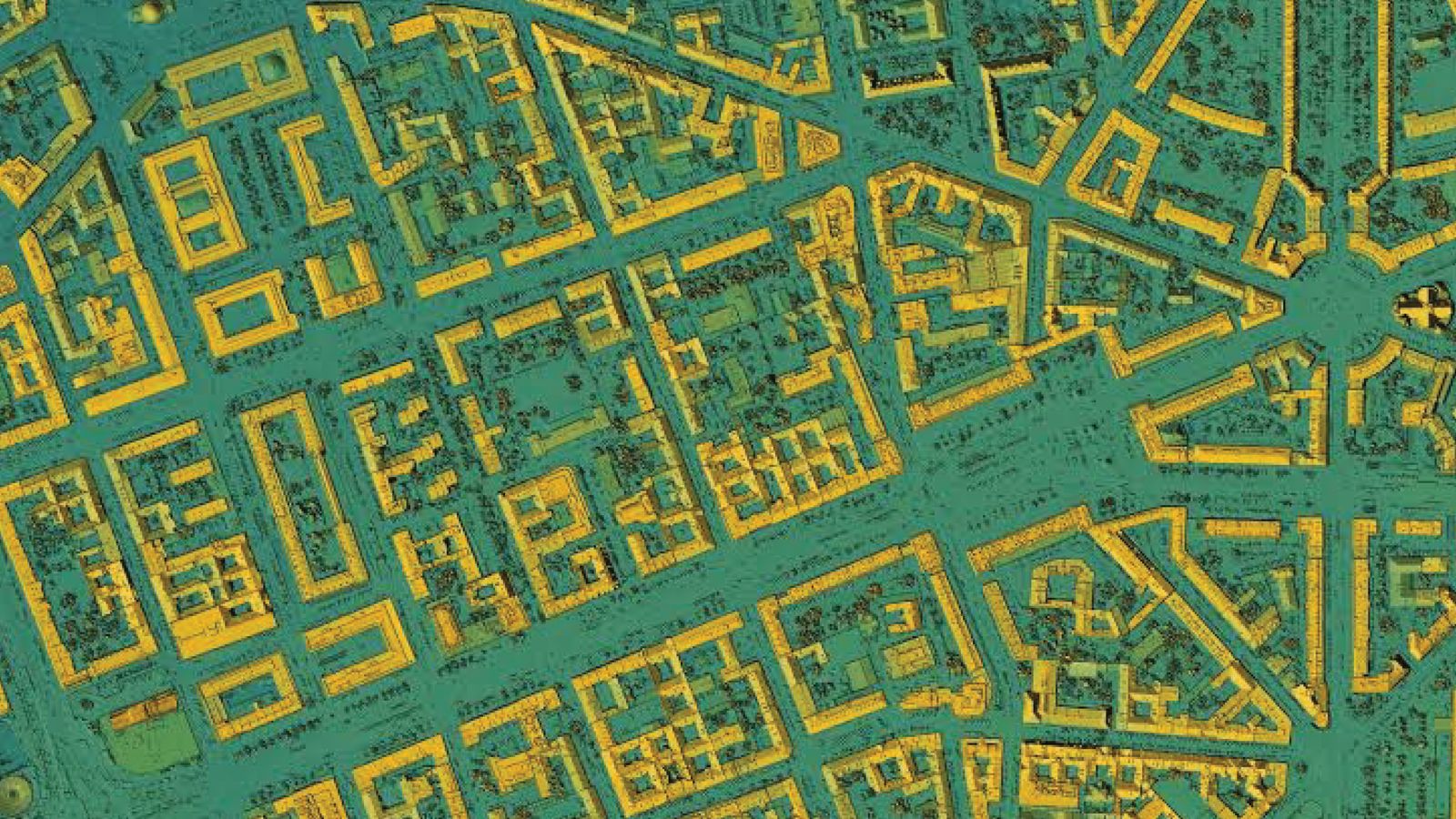
Our 3D City Modelling services bring urban environments to life with high-precision, data-rich digital representations. We create detailed and scalable 3D models of cities that integrate topographical data, building geometries, transportation networks, vegetation, and infrastructure.
LIDAR (Light Detection and Ranging) technology offers unparalleled accuracy and efficiency in capturing detailed, high-resolution spatial data. By using LIDAR services, your projects benefit from:
Precision Mapping: LIDAR provides highly accurate 3D measurements, enabling precise terrain models, infrastructure mapping, and environmental analysis.
Speed and Efficiency: Rapid data acquisition over large areas reduces project time and costs compared to traditional surveying methods.
Versatility: Applicable across various industries including construction, forestry, urban planning, mining, and agriculture.
Comprehensive Insights: Detailed data supports better decision-making, improved project planning, and effective resource management.
“Leverage our advanced LIDAR solutions to transform your spatial data needs into actionable insights with confidence and clarity.”
